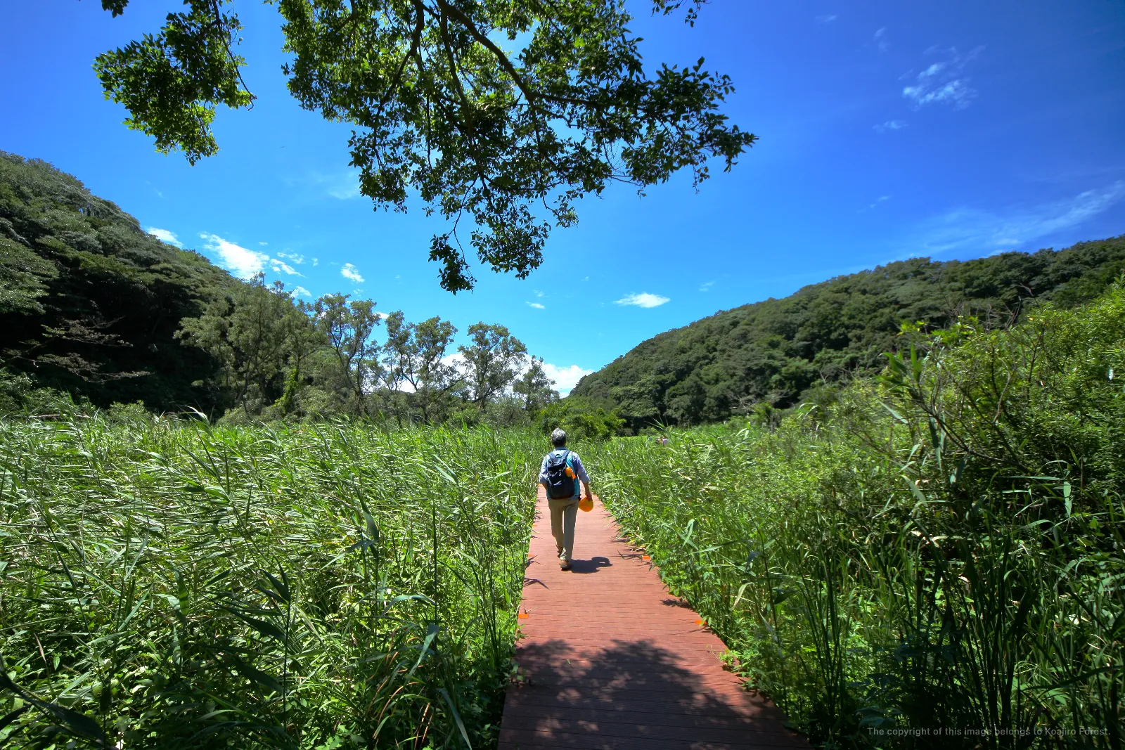
The broad valley floor that sustains the
alder trees and
Japanese willows is blanketed, in every direction, with green. That green is composed of perhaps several hundred species of non-woody plants — yet the plants that define the greater part of the landscape are only a handful: *Miscanthus sacchariflorus* (Ogi), common reed (Ashi), reed canary grass (Kusayoshi), cattail (Gama), Japanese butterbur (Fuki), and lizard's tail (Hangesho). Among these, two species reign supreme in the area they occupy: Ogi and Ashi.
Ogi claims the slightly drier reaches of the wetland. It resembles the more familiar Japanese pampas grass (*Miscanthus sinensis*), yet its plumes and its base are entirely different — it is a distinct species in its own right. In autumn, the feathery plumes of Ogi adorn the wetland in a magnificent silver, conjuring a scene utterly unlike the golden hues of pampas grass. At its base, each stem rises straight and solitary from the ground, again a world apart from the clustered tufts of pampas grass.
Where the water table is high and the ground is prone to flooding, it is Ashi — also known as Yoshi — that takes hold. The two names belong to the very same plant. Its plumes are far larger than those of Ogi and may spread outward in all directions. In the valley floor of Koajiro, from the point where the path emerges through the alder forest onward, the landscape on either side of the trail becomes, for most of its breadth all the way to the sea, a continuous community of Ogi and Ashi. Their respective distributions are governed entirely by the level of the water table.
Interwoven among the Ogi and Ashi, other wetland plants claim their own corners of this landscape. On the forest floor beneath the alder trees, vast colonies of Japanese butterbur spread wide. Around the stands of willow, reed canary grass takes root; in the sun-drenched marshes, communities of cattail and lizard's tail come into being.
Yet this wetland landscape has been undergoing a dramatic transformation over the past decade or so. On March 11, 2011, when the Great East Japan Earthquake sent a surge of water sweeping along the shores of Sagami Bay, the storm tide pushed deep into the interior of Koajiro's wetland, carrying with it vast quantities of invasive plant species. Today, the wetland faces a grave challenge: how to protect its native flora from the disruptive invasive plants — goldenrod (*Solidago altissima*), giant ragweed (*Ambrosia trifida*), perennial ryegrass (*Lolium perenne*), and others — that have spread through the marsh in the wake of that disaster.
At the far edge of the valley-floor wetland, just before it meets the
tidal flat, the vegetation transitions into a large colony of *Aeluropus sinensis* — known in Japanese as Aiashi — a rare wetland plant found nowhere else along the trail. A salt-tolerant species entirely distinct from both Ogi and Ashi, the Aiashi wetland presents yet another pressing question for the future: how shall this precious and uncommon community be preserved?
Key wetland plants: Ogi (*Miscanthus sacchariflorus*), Ashi/Yoshi (common reed), Kusayoshi (reed canary grass), Gama (cattail), Fuki (Japanese butterbur), Hangesho (lizard's tail)
Distribution: Determined by water table level — Ogi occupies slightly drier ground; Ashi occupies flood-prone, waterlogged areas
Rare species: A colony of salt-tolerant Aiashi (*Aeluropus sinensis*), transitioning just before the
tidal flat
Challenge: Conservation of native wetland plants from invasive species (including goldenrod, *Solidago altissima*) introduced by the 2011 tsunami
Related: Valley floor supporting
alder and
Japanese willow communities
Location: Koajiro, Misaki-cho, Miura City, Kanagawa Prefecture
Map:
Koajiro Forest Map
Official Site:
Koajiro Forest (Kanagawa Prefecture)
Supervising editor: Yuji Kishi (Professor Emeritus, Keio University)
Photography: Hiroichi Yanase (Professor, Institute of Science Tokyo)
Producer:
Eisuke Tachikawa (Representative of
NOSIGNER / Project Professor, Keio University)
Published by:
NOSIGNER / NPO Koajiro Outdoor Activity Coordination Council